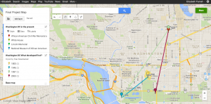
Here is a link to my map on Google Maps.
When deciding what landmarks to chose for my map, I took what I thought was associated with President Abraham Lincoln and paired that with what I thought was associated with the African American culture and era during the civil war. I thought that this would help me decide what to look into when I am researching my topic as to why President Lincoln decided to free the slaves and what his purpose for doing so was. For me it was difficult to layer the map at first but then once I was able to figure it out, I decided that I was going to draw a polygon around the central and oldest building in my locations, which is the White House. After this, I decided to connect the dots and draw a line to the second oldest building and so on. This helped me realize that many of Washington D.C.’s oldest landmarks and buildings are all extremely central to each other, whereas the newest one is farther away which tells me that D.C. has definitely expanded in the last two decades. I don’t really think that creating a historic narrative on a map was necessarily helpful for my topic, however it did help me understand the layout of D.C. more and therefore I can translate my newfound knowledge of the city into what I am researching for my topic. I believe it was definitely an interesting exercise that I will try and use when working on my project in future days to come.


April 4th, 2014 at 12:32 pm
I love the topic. I know that so many aspects of this part of history can be found right in D.C., especially in historical archives and on historical sites. Really informative map!